
13: Building our Mini City: Reimagining Colombo

Illustrations by Irushi Tennekoon
July 8th, 2018
De-Briefing the City
Considering that yesterday was their day-long tour of the city, the students who turned up today were probably the students who really wanted to be there. Having regular turnout was something I truly appreciated. After the excitement of the tour, a student from the English class also joined the ‘art’ class.
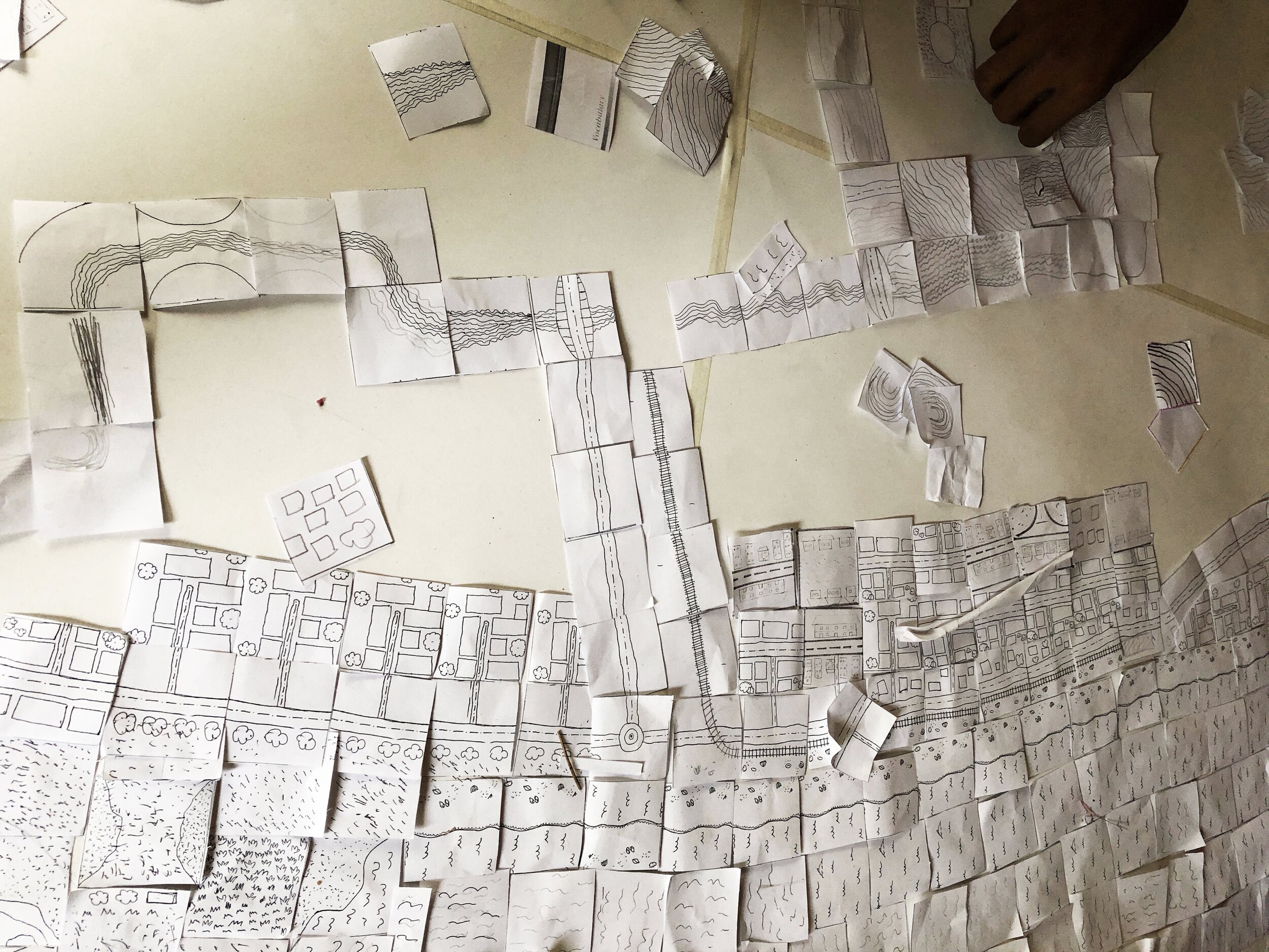
Today’s exploration of our travels around the city was inspired by a board game called Carcassonne. For those who may not know, Carcassonne is a medieval French city, known for its fortresses. This characteristic was reflected in pieces of this board game, and needed to be altered to fit the characteristics of the coastal city of Colombo. We hoped that having a number of set template cards would solve scale-related challenges that so often come with mapping exercises, especially of such a large map. Here are some of the cards we added:

Illustrations by Irushi Tennekoon

Illustrations by Irushi Tennekoon
We displayed real, survey department maps of Colombo on the wall, (1:10,000 and 1:15,000) and also our tour map that demarcated the stops on the tour. We suggested that the students start with outlining Galle road, (It runs parallel to the coast so was a good starting point). Eventually the railway, the park, Town hall, Beira lake, and so forth we’re added. We were also assisted by Google maps satellite view on my laptop. While the older kids clung onto the lesson much easier, several younger kids found it difficult and lost interest.
Because of this, (for the first time in a long time) we separated the age categories, and asked the younger group to make their own map by joining the pieces. The only rules were that the template units had to link to each other in the appropriate way - for example, a road card couldn’t continue with a railroad card, unless it was an intersection card.
It was a slow, arduous process that took most of the day. We intended that the day would end with coloring the cards, as well as building several 3D elements, but only the placing of the maps were complete. Overall I think they learned some interesting mapping skills and this helped outline their observations of at least part of the city.

The younger group’s map
The older group’s map

The Younger group’s map
Update,
February 2019
By the the time their exhibition rolled around, the map was re-visited and this time everybody participated in making it colorful and three-dimensional. Suren, Sahani and Saakya took the lead on supervising the class where needed.

‘Re-imagining Colombo’ at their 2019 Exhibition. Photo by Ms Pramila Gunaratne

The final result. Photo by Sahani Gunasekera